
Southeast Asia Non-Exclusive Gravity & Magnetic Data Interpretations
This two-phase non-exclusive collaboration between Bird Geophysical and Gibson Consulting integrates open-file gravity and magnetic data to produce interpretation maps and 9 mega-regional 2D gravity- and magnetic-modeled cross-sections (each study, 18 total) to identify accommodation zones, basement structures, carbonate buildups, depocenters, fracture zones, ocean-continent boundaries, ophiolites, plate boundaries, subduction zones, and volcanics.
Phase I: Sunda Shelf & South China Sea
Baram Delta
Pearl River Basin
Beibu Wan Basin
Reed Bank
Hong Sa Basin
Sabah Trough
Luconia Platform
Sokang Basin
Malay Basin McClesfield Bank
Song Hong Basin
Mekong Basin
Spratly Islands
Nam Con Son Basin
Thai Basin
NhaTrang Basin
West Natuna Basin
Outer Basin
Yang Ghe Basin
Paracel Islands
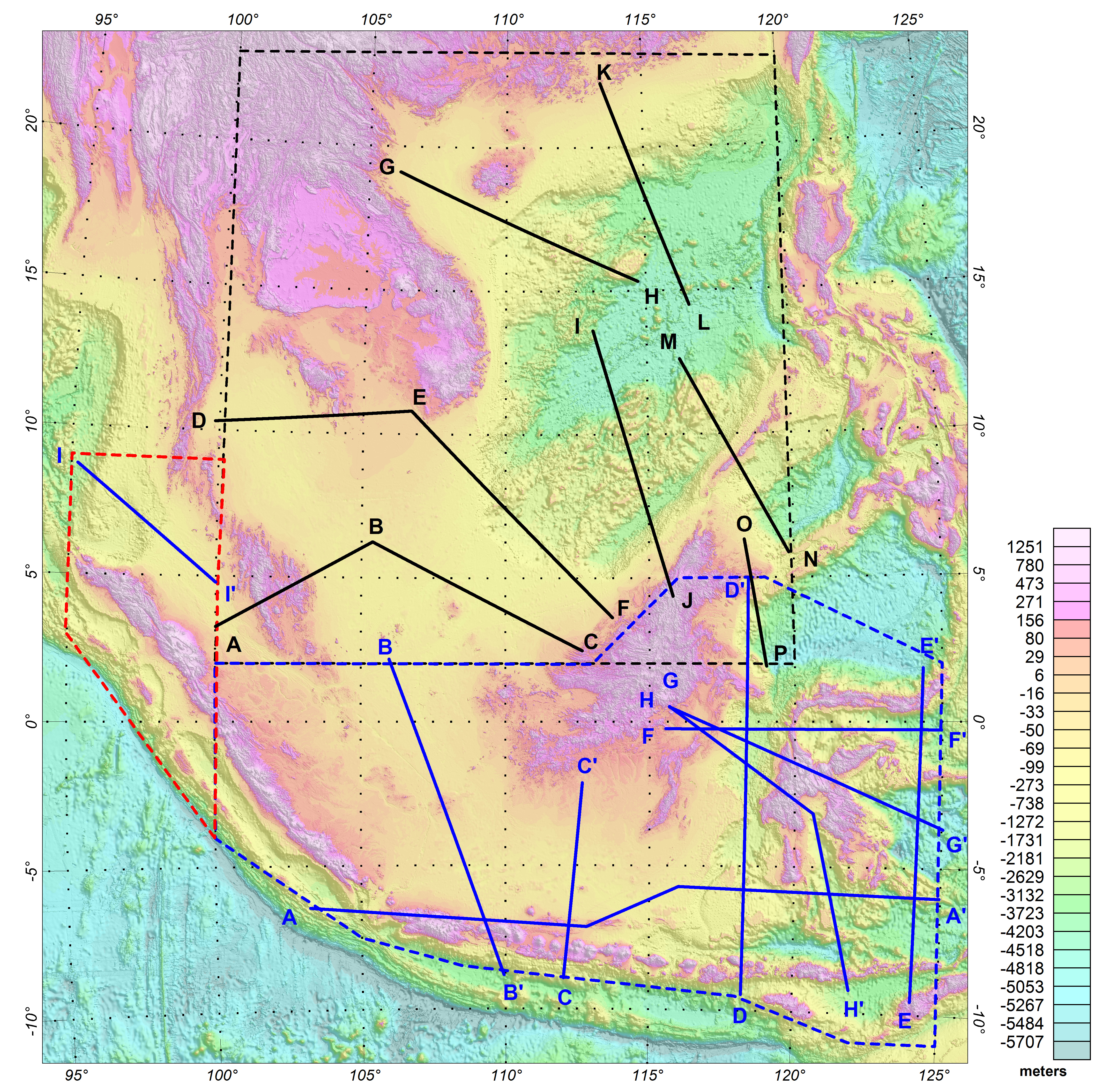
Phase II: Central Indonesia
Barito Basin
North Makassar Basin
Bali Basin
Palembang Basin
Bawean Trough
Peleng Basin
Billiton Basion
Savu Basin
Bone Basin
South Celebes Basin
East Florence Basin
South Kapunas Basin
Flores Basin
Southern Sunda Shelf
Gorontalo Basin
South Sumatra Basin
Java Foreland Basin
Strait of Madura
Kangean Basin
Sunda Basin
Kutei Basin
Tarakan Basin
Mahakam Basin
West Java Basin
North Banda Basin
Download information sheet
click here.
Download Phase I Area of Interest shapefiles (black on map)
click here.
Download Phase I 2D model locations shapefiles
click here.
Download Phase II Area of Interest shapefiles (blue on map)
click here.
Download Phase II Area of Interest extension shapefiles (red on map)
click here.
Download Phase II 2D model locations shapefiles
click here.
For details please contact:
Dale Bird
Bird Geophysical
+1.713.203.1927
dale@birdgeo.com
www.birdgeo.com
or
Dick Gibson
Gibson Consulting
+1.406.490.1556
rigibson@earthlink.net
www.gravmag.com